Photo Friday: TMB Part 4: Courmayeur, the Aiguille du Midi, and the hike continues
Read the complete TMB series: Part 1 Part 2 Part 3 Part 4 Part 5 Part 6
Courmayeur Rest Day #1
After about 5 days of significant hiking, we were happy on our first day in Courmayeur to just play tourist in a lazy fashion. We did a walking tour of town, including the old town of Dolonne across the river, before returning to our hotel to spend the afternoon resting.
The morning started with beautiful sights indoors...
... and out.
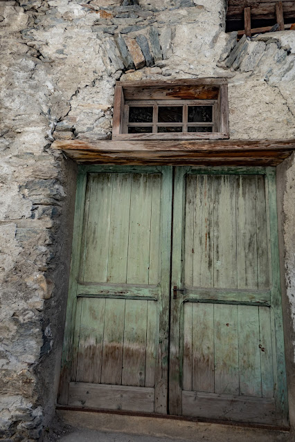
Old Dolonne.
 |
| I am always fascinated by the ancient walls and doors in places like this. |
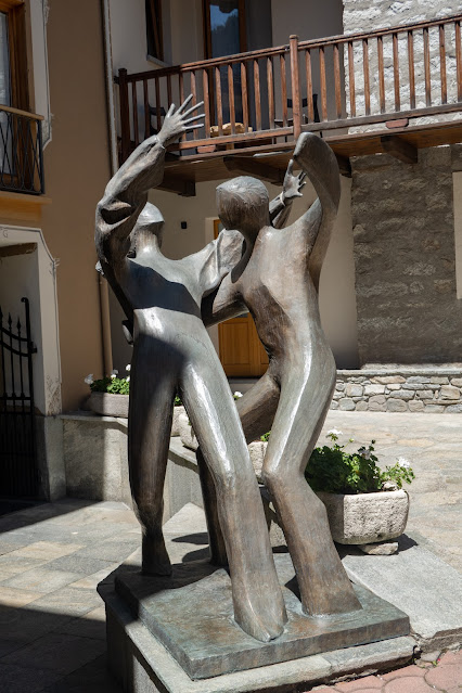
By way of contrast with all the old buildings, we found this very modern sculpture tucked into a courtyard not far from our hotel.
 |
| I could find no markings indicating title or even who made it. |
For the record, our restful wanderings totaled about 4 miles.
Courmayeur Rest Day 2: Mt. Blanc Skyway
Our second rest day was more exciting, and involved much less walking. Having figured out how the day before, we took the bus up the valley a bit to take the Skyway Monte Bianco cable car to 11,040' (3366 meters) and a panoramic viewing platform.
 |
| The giant cable cars hold about 80 people and rotate slowly as they move, so that you can see all directions (if you avoid getting stuck in the middle of the crowd). |
I was intrigued to see the entrance to the Mt. Blanc tunnel here. The tunnel, which opened to traffic in 1962, is an important shortcut through the mountains. It passes under the Aiguille du Midi, and emerges at Chamonix--following almost the same route you can take through the air via cable cars.
 |
| Tunnel entrance plaza |
We emerged at 11,000' and climbed about six flights of stairs to reach the panoramic viewing platform.
It takes two panos to get the whole 360 degrees, but this will give you the idea.
 |
| Looking back down towards Courmayeur in the center, with Monte Bianco on the right and the Dent du Geant on the left. |
Carol chose to head back down, but Tom and I spent the extra money and took the much smaller Panoramic lift over to the Aiguille du Midi (and thus back into France for a couple of hours).
 |
| These little cars are why Carol didn't go. But it was nice--they only seat 4, and we were able to claim one for just the two of us--no masks needed, and plenty of room to shoot photos from all sides. |
 |
| The glaciers are teeming with activity as climbers head up everything in sight, and classes learn skills, teams are camping, and who knows what all else. |
 |
| Monte Bianco/Mt. Blanc. I think by now we're in France... |
The crossing is about 5 miles, and takes 30-40 minutes. Then you approach the insane construction on and in the Aiguille.
 |
| Coming into the station on the right. |
We took our time and explored all the different viewing platforms (traveling between them through tunnels and up and down stairs, mostly inside the mountain), and took the lift to the top of the Aiguille (12,6045'/3842 meters). From here you could drop back down to Chamonix if you wanted--it would be a spectacular way to end a shorter hike around only one end of the massif.
 |
| The Mer de Glace, at the point where it drops out of the basin and into the valley. |
This made for an all-day outing with almost no walking, though some high elevations to cope with. It was a pretty rewarding rest day!
TMB Day 5: Courmayeur to Rifugio Bonatti
This day's hike had an "easy" option and a long, hard one. Our party divided along predictable lines, with Tom and me heading for the high route where the photography promised to be rewarding, while Carol enjoyed the low route and a more relaxed day.
The two routes go together for the first two or three miles, and we found as we were leaving town that we were also on the route of the Grantrail Courmayeur, an endurance race with 30, 60, and 100 kilometer options.
 |
| Our first hint. |
The 100k runners had left the night before and went different places, but the 30k left not too long after we did, and for a time our route was overrun with runners. By the time we reached the top of the first climb and our separation point, they were mostly past us, with only a few stragglers pausing to take a photo or enjoy the view.
 |
| The climb from the junction was... steep. |
The views were all they were advertised to be, and the wildflowers were a fantastic addition.
It was a long hike, though, and I can't deny that the best sight of the day may have been the Rifugio. The Bonatti hut is new, beautifully and intelligently designed, and had clean, hot showers, spacious private rooms (for 3 in our case, as they can't accommodate singles), as well as a substantial dormitory. The food was good, and adequate in quantity, though the breakfast was not as abundant as what we would get in the hotels (it was, however, self-serve and all-you-can-eat, so it was the selection, not the quantity, that was limited).
 | |||
| Bonatti hut, as we approached from behind. Our route brought us down the valley to the hut, rather than approaching from below and to the left (in this photo) as the main trail does. |
There may have been one thing more beautiful that day than the sight of the hut: a plateful of food.

Stats: 10 miles, 5200' up and 2500' down, taking about 8 hours including all the photo and meal stops. For the record, the main trail is about 7 1/2 miles and gains about 2800', with only about a 330' loss.
Apologies for an unmercifully long post! This one may have to do for two weeks as I'm not sure if I'll be able to post next Friday, so that's my excuse :)
©Rebecca M. Douglass, 2022
As always, please ask permission to use any photos or text. Link-backs appreciated.
Don't miss a post--click the "Follow-it" link below!


Comments
Post a Comment
Let us know what you think! We love to hear from our readers!