Photo Friday: TMB Part 6: Champex-Lac to Chamonix
Check here for the previous posts in this series: Part 1 Part 2 Part 3 Part 4 Part 5
TMB Day 8: Champex-Lac to Col la Forclaz, via Fenetre d'Arpette
This was another day for us to split the party. My companions had done the Fenetre d'Arpette several years before on another trip, and encouraged me to do it but showed no desire to repeat the trip (for reasons that became clear to me). As a result, we split up not long after leaving our hotel in Champex-Lac, though I can't say I was hiking alone. I'm guessing more than half of TMB hikers on that day chose the higher and harder route. Though there were stretches where I enjoyed a little solitude, they never lasted long.
 |
| Dawn from the hotel balcony. |
We headed out at the usual time--about 8 a.m. I walked with my companions to the edge of town, then said goodbye and headed up the mountain alongside a tumbling mountain creek.
 |
| Can't seem to find a name for the creek, but it was a pretty mountain cascade, once I climbed above the parts where it was an irrigation ditch! |
After the first sustained climb, things flattened out briefly at the hamlet of Arpette, to cross several fields (cue cow bells) before resuming the climb.
Soon the climb resumed in earnest, and the landscape changed from agricultural to alpine. I felt like I was back home in the Sierra.
The climb got steep and required more and more scrambling over and through boulders and scree. The final push was a tangled mess of super-steep tracks through the rocks and dirt to the pass--the "fenetre" (window).
 |
| This was a fairly discouraging view of the remainder of the climb at late morning. The pass is the low point on the ridge and I could see other hikers had already summitted. |
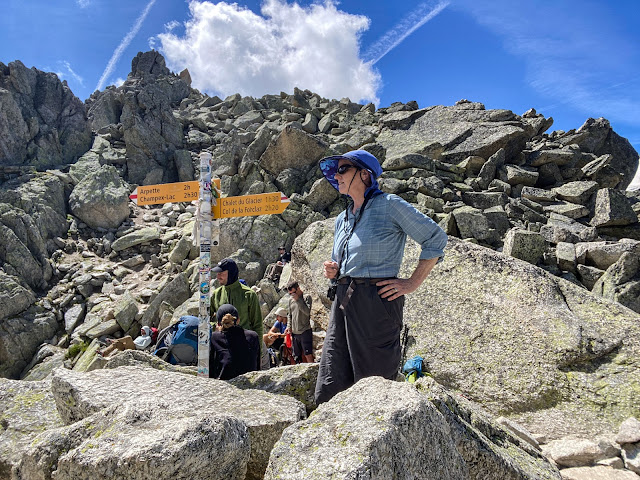
Persistence paid off, as usual. I made the summit in time for lunch, along with many other hikers. I found a corner out of the wind and enjoyed the view while wondering just a bit how I was going to get down.
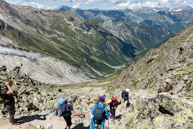
From where I sat I couldn't even see a trail, just a very steep boulder field. Once I approached the edge, though, the trail became clear (and not *just* because other hikers were on it). There was no denying it was steep.
I had to stop a lot on the way down to turn back and enjoy the views I had come for, of the Glacier du Trient and assorted peaks. Stopping of course had absolutely nothing to do with the fact that the trail was so steep my knees were cursing me in three languages.
Eventually I reached the much-awaited Chalet Glacier, marking the end of the roughest trail. Though I had made it down the worst of the descent, I still had a mile or two to go before I could stop. It took a little concentration to enjoy the pleasant, flat walk along a historic irrigation channel to the Col de la Forclaz.
Stats: 8.6 miles, 3800' up and 3700' down.
TMB Day 9: Col de la Forclaz to Argentière
Another fairly long day, this one started with an easy descent to Trient, before we began a long climb toward the Col de Balme. Temperatures were also climbing, as these last two or three days we seemed to have moved strongly into summer. In addition, we were coming back around to the damp side of the mountain so humidity was increasing. The climb out of the valley was long and hot, despite my atypical decision to wear shorts. (I almost always hike in long pants to protect myself from sun, bugs, and plants that can irritate the skin).
 |
| On the descent to Trient, looking back up to see the light pouring through the Fenetre through which I had just climbed. |
The climb was pretty, but not spectacular, and the excitement of the day lay in knowing we would eventually reach the pass and once again see Mt. Blanc and the highest peaks.
 |
| Topping out with the refuge and the peaks |
The climb was a bit hard because of the heat, but we were there in time for an early lunch as we took in the panoramic vistas.
 |
| The intrepid hikers. |
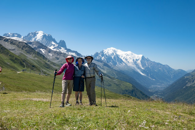
From Col de Balme on, we were consoled for aching feet and knees with uninterrupted views of Mt. Blanc and the Chamonix valley. I may just possibly have taken too many photos, but I'll spare you all but a small handful.
 |
| The outskirts of Argentière--actually the town of Montroc, a couple of hundred feet above our destination--comes into view at last, a sadly long way below us yet. |
Hammering down the hill all afternoon brought us to town shortly after 4. We visited the grocery across the street and laid in a feast, having no patience for leisurely European dining--we were hungry! Then I kicked back in my room, which was on a corner and had views of the mountains in two directions--truly a luxurious room by my standards.
Stats: 10 1/4 miles, 3065' up, 3950' down. Definitely a two-ibuprofen day.
After another excellent breakfast we caught our bus, and were on the lift to Flegere before 9 a.m.
Once again we had views of Mt. Blanc all along the way, now noticeably closer to us. The hike wasn't flat, even in the first part that looked like a simple traverse, but to our relief downhill bits were limited.
Our views of the mountain now also often had parasails in them. The area is a huge parasailing center; many of the fliers we saw were doubles with tourists getting a ride in the hands of an expert.
 |
| Sunset on Mt. Blanc, right from my room (maybe from my bed). |
Stats: 10 1/4 miles, 3065' up, 3950' down. Definitely a two-ibuprofen day.
TMB Day 10: Flegere to Brevent
Our final day we didn't try to walk the TMB route. We had already hit some of the high points on our hike to Lac Blanc while we were adjusting to travel and elevation. Instead, we caught a bus down the valley to Flegere (the start for Lac Blanc), took the lift up and started walking the other way. Our goal was Brevent, the high point of the trail between Argentière and the end of the trail at Les Houches. Doing the entire trail would have involved continuing for many more miles, basically all downhill--something none of us cared to do.
 |
| Sunlight hits the top of Mt. Blanc--time to get up! |
After another excellent breakfast we caught our bus, and were on the lift to Flegere before 9 a.m.
 |
| View of the valley from the cable car. Chamonix is the biggest cluster of the building in the distance. |
Once again we had views of Mt. Blanc all along the way, now noticeably closer to us. The hike wasn't flat, even in the first part that looked like a simple traverse, but to our relief downhill bits were limited.
Our views of the mountain now also often had parasails in them. The area is a huge parasailing center; many of the fliers we saw were doubles with tourists getting a ride in the hands of an expert.
 |
| Across the face of Mt. Blanc |
By the time we reached the midway lift station below Brevant, my companions had decided the day was too warm to climb to the summit, not when there was a lift handy to do the climbing for them. For reasons beyond any fathoming, I felt like I hadn't hiked enough, and chose to do the climb while Tom sought the perfect photo of parasails and mountains.
 |
| It was a temptation, but fortified by my lunch, I kept right on going past the cable car, beating the predicted time to the top by 20 minutes. |
I
did get off the correct trail for a few minutes, following a climber's track until I
decided that wasn't my way. When on the correct trail, however, it was almost all easy. Almost--but not quite. When you are just a short way below the summit, you are confronted with a bit of a rock scramble, and then a series of ladders and other aids to climbing. That helped me to understand why many people hike the service road instead of the much more pleasant trail.
 |
| The ladders. Fortunately, though I don't like exposure, I'm pretty comfortable with this kind of thing, especially going up. Descending is another matter. |
The view from the top was worth the price of admission, whether you paid it in cash (up the cable car) or sweat (up the trail).
 |
| Brevent summit. The table in the foreground labeled mountains in all directions. |
I thought by the time I reached the summit my companions would have been and gone, if they had come up at all, but thanks to photographic distractions they were there, and just getting ready to descend. They waited while I looked my fill, took a little snack, and looked a bit more. Then we headed for our hotel, for the last time on the TMB. Down two spans of cable car and a steep street, then a walk across town, took us to showers and clean clothes.
Stats: 5 miles. 2435' up, less than 400' down.
Total TMB stats: 103 miles, 32,500' up, 29,500' down. (Note that this is not actually the entire trail length, which is longer. True purists would walk all the way from Argentiere to Les Houches, and wouldn't take the lifts we did. Their total up and down would probably be another 10,000' beyond ours. In my opinion, taking lifts where available is only sensible--they usually cut out long, steep ups or downs that are the least scenic. On the other hand, we mostly avoided shortcuts by bus, which would not be a net benefit unless one is injured or ill, as you would tend to miss the best scenery.)
My general take on the trip: This is an amazing hike, well worth its popularity. For me, that popularity detracts from the overall effect, but I have no regrets about doing it. Nor do I regret using hotels instead of backpacking. In my opinion, with the exception of a few places where one could camp high but you have to descend to use hotels, you would lose most of the scenic benefits of camping. Fiscal benefits are another matter, and for many camping could make an undeniably expensive trip doable.
I probably would choose to stay in more mountain refuges, despite less comfort, for the sake of more alpine sunsets and sunrises. On the other hand, in a time of plague such as we are in, the communal sleeping and eating arrangements of such places are less appealing, and we used only those where we could have a room to ourselves.
Going with friends is a wonderful approach, but if you were to go solo, it would be easy to make trail friends, especially if you are younger. There were a fair number of hikers in our age range, but I would say that the trail skews younger (see elevation and mileage notes, above).
If you are interested in going, many companies offer fully guided trips or self-guided trips (our approach) where they arrange lodging and logistics (including baggage transfers) but you control where and for how long you'll stay, select your routes and your pace, and use your trusty navigation app to find your way (or just follow everyone else). We arranged our trip through Alpenwild and were very happy with what they did for us. It is probably as well for someone like me to get a bill for the total and never see what some of the hotels cost--I might have missed out on some nice nights if I'd seen the price tag!
 |
| Final sunset on Mt. Blanc |


Comments
Post a Comment
Let us know what you think! We love to hear from our readers!